Coming to the Mas de la Calade
Your itinerary with Google Maps
Coming to the Mas de la Calade
GPS coordinates: 43°24'04''N - 5°42'42''E
Coming from the motorway "A8". Go out "Saint Maximin" then follow the indications "Saint Zacharie".
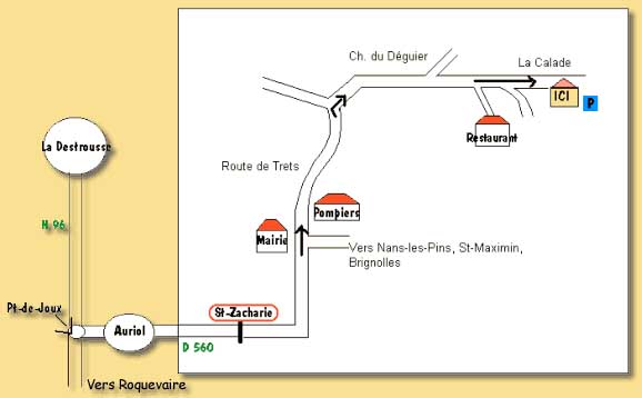
Coming from the motorway "A52". Go out "Pas de Trets". You go through "La Destrousse" then Auriol and follow the indications "Saint Zacharie".
In the village of Saint Zacharie, turn at the city hall on the road to "Trets" (D85) follow this road around 1.5 km. At the two ancient coal silos level, the road turns as a hair-pin bend and the way you have to follow is in the middle of the bend.
That's this way you follow during 1 km. At the first fork, turn right, at the second one, turn left. Then you go and see the "Mas de la Calade".